Manage Plans
This dialog box allows the user to create and edit Plans or Parcels.
See below for procedure for Creating Parcels by first creating strings.
Plans
This is the list of Plans in the Job.
If the 'Show Lots' option is ticked, it will also display the Parcels.
Add
This option will create a new Plan. You can then edit the planto set the name andother properties.
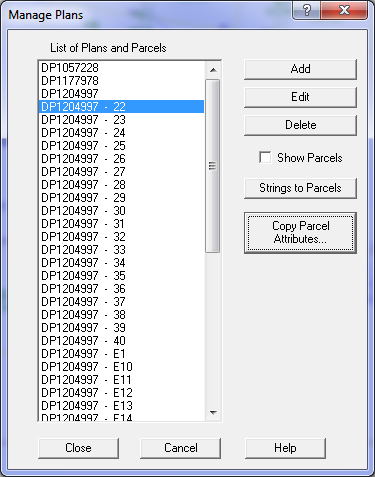
Edit
This option will edit the selected Plan or Parcel.
Delete
This deletes the selected Plans and/or Parcels
Note that if you delete a Plan, it will also delete any parcels on that plan.
Show Parcels
This tick box control whether parcels are displayed in the plan/Parcel list.
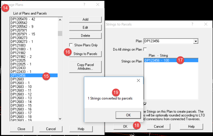
Strings to Parcels
This option will allow you to select a plan and then form the parcels from strings for that plan.
It will use the Lots on thae selected plan to form parcels.
It will also use any connections on the plan to add connection lines to the parcels.
Copy Parcel Attributes
Allow you to copy attributes from the selected parcelt o one or more other parcels.
Select a parcel before pushing this button.
Create Parcels by Strings
1. To enter a NEW PLAN
- Select Strings/Manage Plans
- Click Add and then type the new plan name and attributes. Save it and
close both Edit Plan and Manage Plans dialog box.
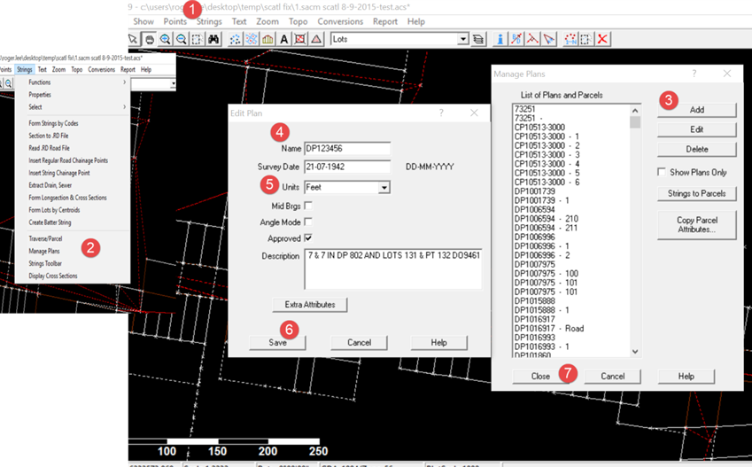
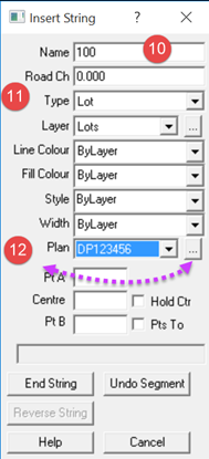
2. To enter String/Lines
- Select the Strings Menu again and select Insert String
- Add the string/parcel name (the string you're creating) in the Name field and select the Plan Name
from the drop down box. Pay attention to the layer for the string
- Click on the points around the perimeter of the string to create it and when closed click on End String

3. Convert String to Parcel
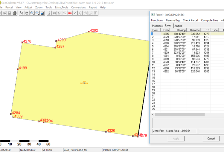
- Open the Manage Plans dialog box again and select the relevant plan (DP123456 in this example)
- Select Strings to Parcels
- Select the string to convert in the list
- Click OK and the program will confirm the creation of the string (parcel 100 in this example)
- Save the job
- The new parcel 100/DP123456 will appear in GeoCadastre as a joined parcel.
- If Plan Properties selected during plan creation were in feet or metres the parcel will have
dimensions in GeoCadastre
which have been computed from the coordinates of the selected points and
expressed in the units selected in Plan Properties.